


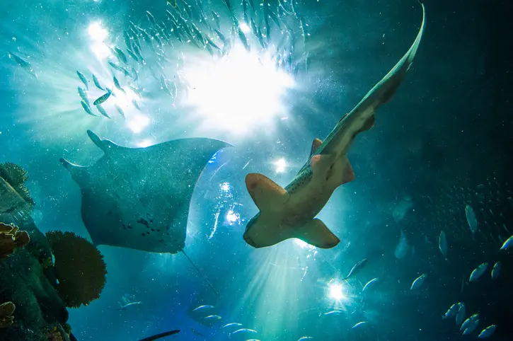
Sharks and their relatives may seem common thanks to their constant appearances in nature documentaries and pop culture, but they face enormous threats wherever they swim and are actually some of the most threatened animals in the world.
Protecting this globally distributed and occasionally highly migratory group of animals isn’t easy — it requires an enormous amount of scientific data, expertise, and collaboration. But an ambitious initiative called the Important Shark and Ray Areas project hopes to help jump-start a new era of conservation for these amazing and misunderstood animals.
Launched in 2022 and managed by the IUCN Species Survival Commission Shark Specialist Group, the effort has brought together hundreds of experts at regional workshops across the globe to help identify sharks’ and rays’ essential habitats. The core team is led by SSG chair Dr. Rima Jabado and features several marine conservation scientists with expertise in spatial ecology and conservation. Their collective goal: Publish a set of publicly accessible, data-driven, interactive maps that can help conservationists, governments, and other interested parties see where sharks live so they can identify the most important waters to conserve.
After months of effort, the first Important Shark and Ray Areas maps went online this summer.
“An ISRA is a place that matters for sharks, rays, or chimeras,” says Dr. Rima Jabado, the chair of the IUCN Species Survival Commission’s Shark Specialist Group and the lead of the ISRA project. “This is an area that we can put on a map and say based on the evidence, this place is important for these species during some or all of their life.”
Prior to this, one of the Shark Specialist Group’s primary efforts, like other IUCN groups and committees, has involved identifying the conservation status of its focal species — which shark species are at-risk, endangered, or have potentially healthy populations. The new maps make that data more actionable.
“Species assessments tell us which species are in trouble, but conservation action has to happen in real places,” Jabado says. “Managers need maps!”
What Counts as an Important Shark and Ray Area, and Who Decides?
While reducing unsustainable fishing practices and curbing international trade are vital parts of shark conservation, it’s also critical to identify and protect key habitats that these animals need to survive.
But what counts as a key habitat, and how do you measure it?
To answer these questions for sharks and rays, the ISRA team started by adapting existing conservation standards like Key Biodiversity Areas and Important Marine Mammal Areas to the life history and ecology of sharks and rays. The resulting 2022 paper, called “Putting Sharks on the Map,” outlined a series of criteria that would help prove that a given patch of ocean is especially important to one (or more) threatened species of shark or ray.
“We often talk about the ocean as if it is one big open space, but from the perspective of species, that is not true at all. Different places matter for different reasons,” says Jabado. “Some areas are important because there is food, some areas are important because they are safer for young animals, there are places used for mating, giving birth, laying eggs, resting, cleaning, or gathering seasonally. For migratory species, certain areas act like stepping stones across the ocean.”
The paper established four major criteria that can be used to identify whether or not a given habitat is an Important Shark and Ray Area. One such criterion covers habitat used by range-restricted species (those that live in just one or a few small regions). Others include a threatened species using the habitat for mating, or their pups using it as a nursery area. Areas with unusually high biodiversity of sharks and rays can also be considered ISRAs.
For example, Albatross Bay in Queensland, Australia, is a pupping ground for critically endangered dwarf sawfish and therefore considered an ISRA for reproduction. The Eastern Kerguelen Slopes, off the coast of Antarctica, received an important area classification because it’s home to severely range-restricted Kerguelen sandpaper skates, who depend on that habitat almost exclusively.
Hundreds of expert participants have helped to identify these ISRAs through a series of 13 regional workshops held around the world over the past few years. For example, the Polar Waters workshop resulted in identifying 34 ISRAs.
Anyone, not just scientists, was free to submit a potential ISRA and provide evidence in support of their claim; an expert independent peer review panel considered all the evidence. Some ISRAs were identified based on information provided by SCUBA tour operators, resulting in biodiversity hotspots that weren’t on any scientist’s map.
“The Mediterranean workshop saw shark researchers and experts coming together to collaborate in an unprecedented way,” says Simone Niedermueller, the Manager Species Recovery for WWF’s Mediterranean Marine Initiative. “The ISRA process allowed for some data to see the light of day when they had been sitting in drawers for years.”
“The key point is that the process is evidence-based,” says Jabado. “We are not identifying areas because they are politically easy, or because someone wants them protected. We are asking ‘what is the evidence that this area is important?’”
So far the ISRA team has identified more than 1,000 ISRAs, which have been displayed on an interactive e-Atlas that’s searchable by size, location, and species involved. Some are huge — the largest, a migratory area used by blue sharks, is over a million square kilometers — and some are the size of a small cove. Some are close to shore, in the middle of the ocean, in shallow water, or in the deep sea. Each ISRA has its own fact sheet with evidence and citations. Users can also download data layers for GIS analyses, letting scientists, governments, and environmentalists use them for their analyses and conservation planning.
As of August 2026, all 13 planned regional workshops have been completed, and the results of 11 have been finalized and uploaded to the e-Atlas. And in a few years, the team will update the map through more workshops.
From Designation to Protection
An Important Shark and Ray Area doesn’t automatically receive any legal protections. The designation is intended to inform future management; if someone wants to create new marine protected areas, this data can help make sure that they’re placed in parts of the ocean that do the most good instead of placing them somewhere that won’t help very much at all.
“Once an ISRA is identified, it can be a very useful layer for decision-makers,” says Jabado. “Governments can use ISRAs in marine spatial planning, fisheries management, protected area planning, and other conservation processes. But ISRAs are not the end point. Identifying an important area does not automatically save it.”
Now that this data is available, the next step is up to concerned citizens, environmental nonprofits, and governments.
“Important Shark and Ray Areas are one of the key biodiversity datasets that can be used to create the first generation of high seas marine protected areas under the recently ratified United Nations treaty to conserve biodiversity beyond national jurisdictions,” says Dr. Lance Morgan, the president of the Marine Conservation Institute.
ISRA data can also be used in national waters for conservation. “We’ve submitted Mediterranean ISRAs in a series of national and regional marine spatial planning processes in Spain, Italy, and Croatia,” says Simone Niedermueller.
Dr. Jabado stresses that marine protected areas are one kind of policy outcome that can ISRA data can be used for, but not the only one. The information can also be used to improve fisheries-management policies, such as instituting gear restrictions or innovations that reduce bycatch of sharks and rays.
“The point is that sharks, rays and chimeras are finally becoming visible in spatial planning and management decisions where they have often been missing,” she says.
More than 1,600 scientists from around the world have spent years identifying the most vital habitats for threatened species of sharks and rays. The next step is up to us.
—
This post was previously published on THEREVELATOR.ORG and is republished on Medium.
—
Subscribe to our Email Newsletter:
Why Subscribe? Because this conversation matters.
When you subscribe, you’re directly supporting independent, mission-driven journalism about masculinity, relationships, mental health, fatherhood, and social change. Your inbox becomes part of a movement that’s been challenging stereotypes and expanding what it means to be a good man since 2010. Plus, our newsletter is curated by humans, not algorithms — thoughtful context in an AI-flooded world.
The Good Men Project is a mission-driven men’s media platform. A major platform for stories about men, identity, fatherhood, and emotional intelligence—and a trusted home for the national conversation about masculinity.
The Good Men Project accepts paid guest posts and provides bulk guest post packages for SEO agencies and resellers. Email [email protected] for more information

If you believe in the work we are doing here at The Good Men Project, please join us as a Premium Member today.
All Premium Members help support our mission and get to view The Good Men Project with NO ADS.
Need more info? A complete list of benefits is here.
Photo credit: iStock.com

